Location of Every Photo From the ISS
March 2013
Since the first mission to the International Space Station over 12 years ago there have been over a million photographs taken by astronauts looking out from four hundred kilometers above Earth. Nearly all of them have been archived on NASA’s servers. I’ve crawled that archive, pulling down the location for each of the 1,129,177 photographs taken from the ISS1.
The Data
Downloads:
Files
The data exists in a collection of .csv files in the folder data. There is a
file for each ISS mission, ISS001.csv, ISS002.csv, etc. in the following format:
| Column: | Mission-Roll-Frame | Latitude | Longitude |
|---|---|---|---|
| Example: | ISS001-E-5411 | 45.5 | -122.6 |
Visualization
If we draw a dot for the location of every photo of Earth taken from space what do we see?
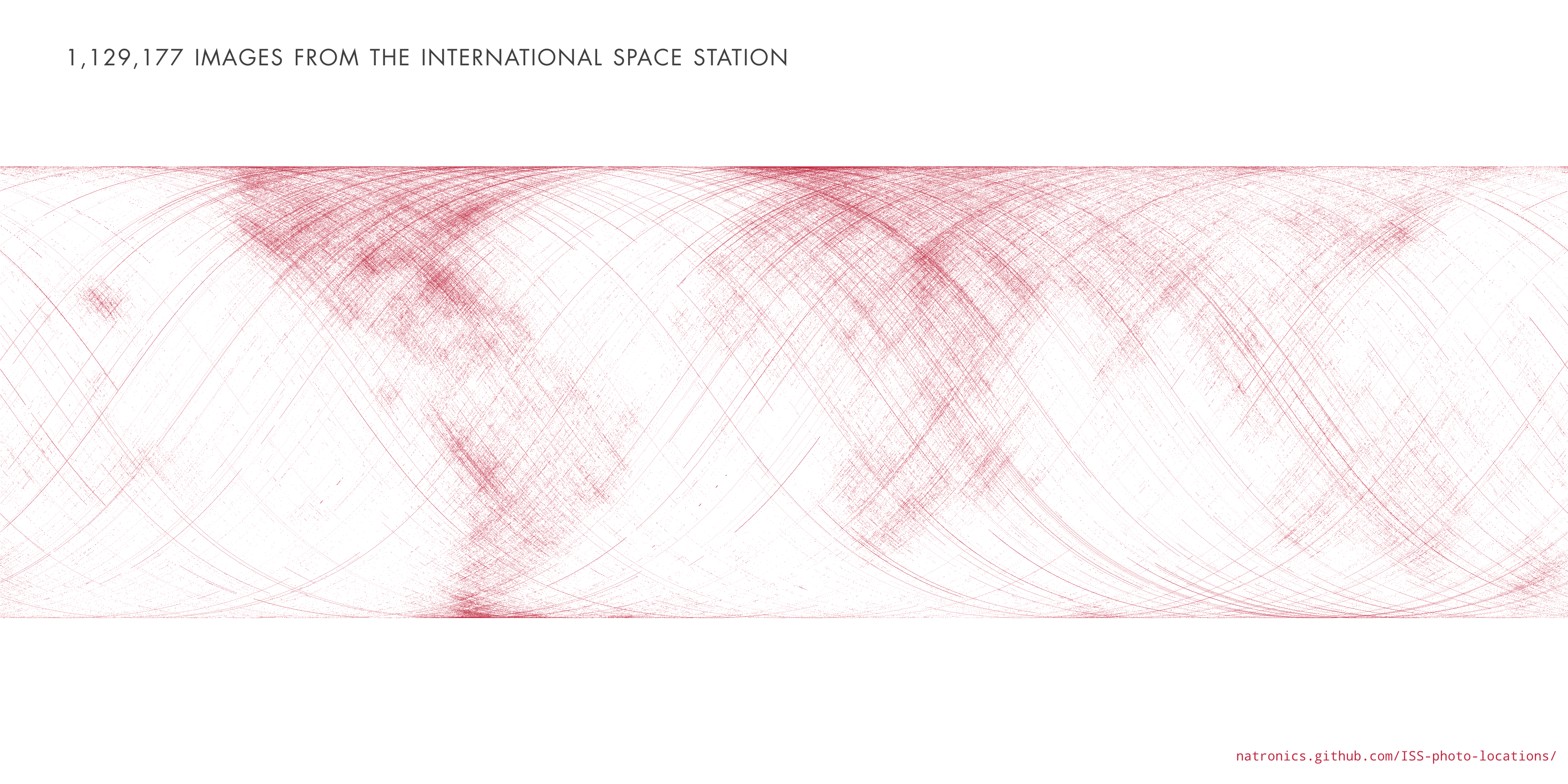
Most of the photos are taken of land. Coastlines, islands and cities seem to be popular targets. So much so that it’s possible to make out basic continents. This makes sense, photos of clouds over an otherwise blank ocean get old after a while. I’m sure every astronaut has taken at least one photograph of the town they grew up in.
Now let’s divide up the dots by mission. Is there any pattern? Here each mission is shown in a different color:
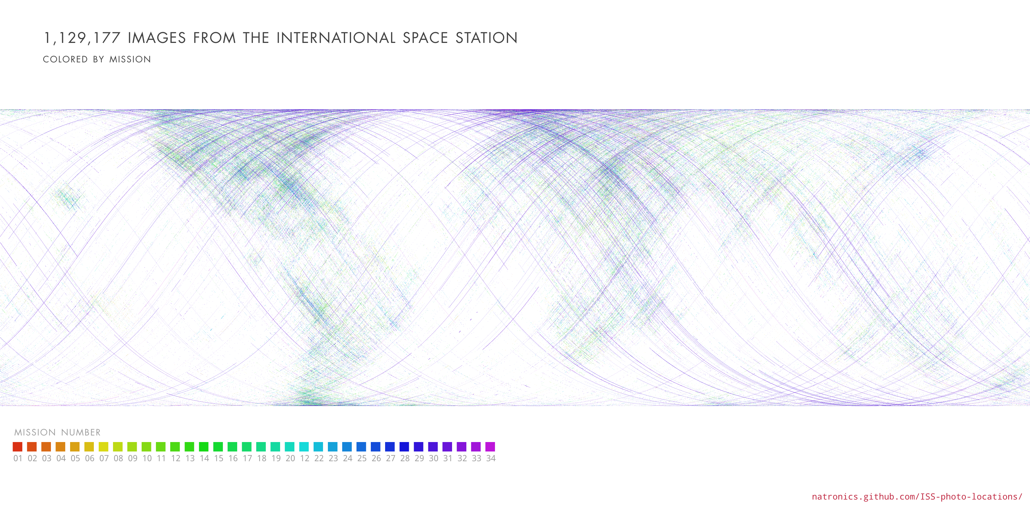
The map is dominated by purple, light blue, and green with some yellow2. I also notice that the purple dots make almost uninterrupted orbit lines while most of the other dots seem to fill in randomly. This is because during ISS 30/31 Don Pettit took dozens of amazing time lapse sequences consisting of hundreds of images taken continuously as the ISS orbited. In fact he’s single-handedly responsible for almost half the images taken on orbit!
Here’s the breakdown:
Photo count by mission
One more thing we can do is add a map underneath to see exactly how the photos line up:
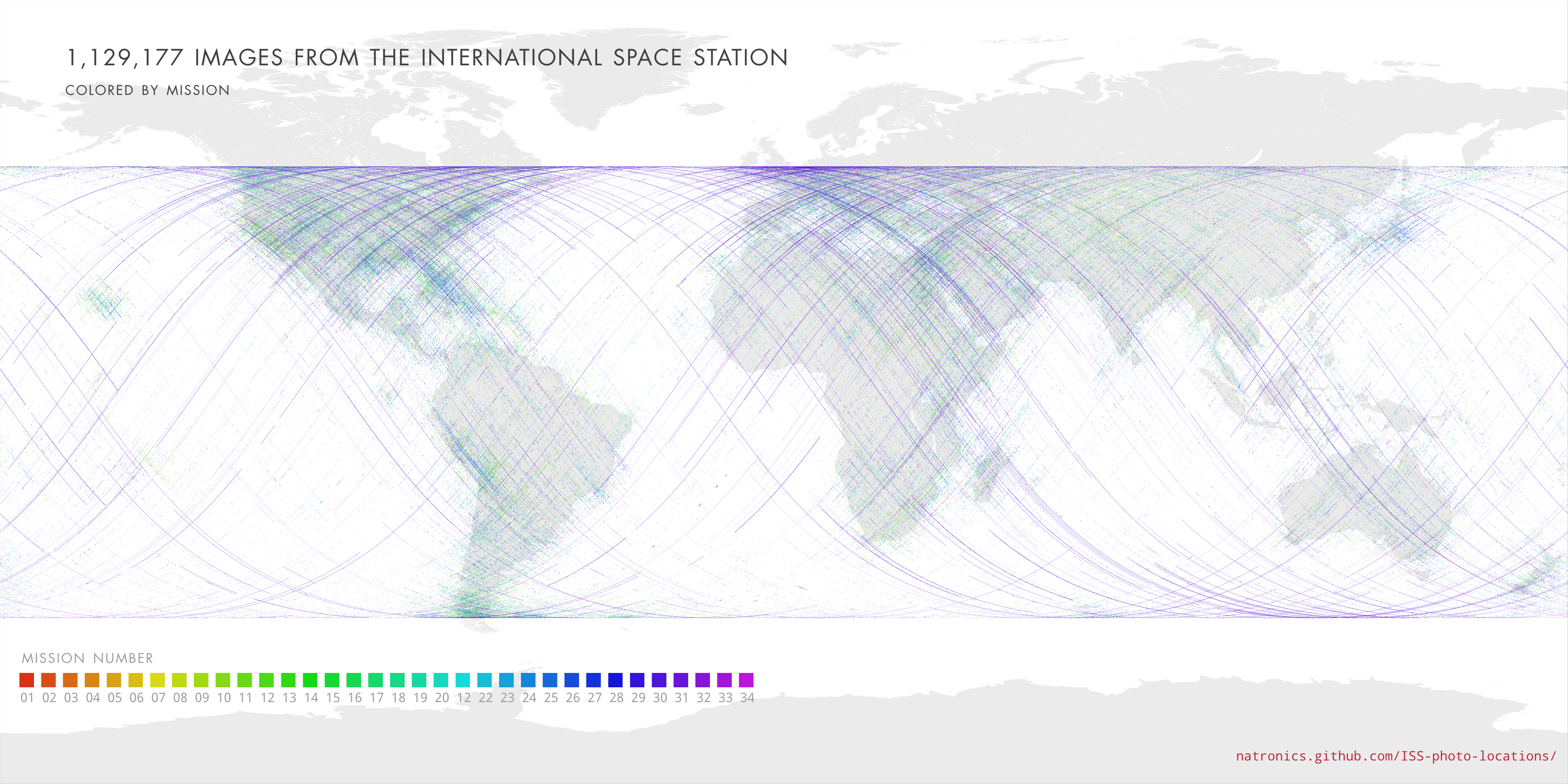
Here you can see that the ISS stays between about 50° and -50° latitude as it orbits the Earth The inclination of the orbit of the station is in fact 51.6°. This is high enough that it can communicate with ground stations in Russia, while low enough that vehicles launching from the USA can reach it.
Since it’s hard to see the overlapped colors in the above image here is a collection maps with the photos from each mission mapped separately:
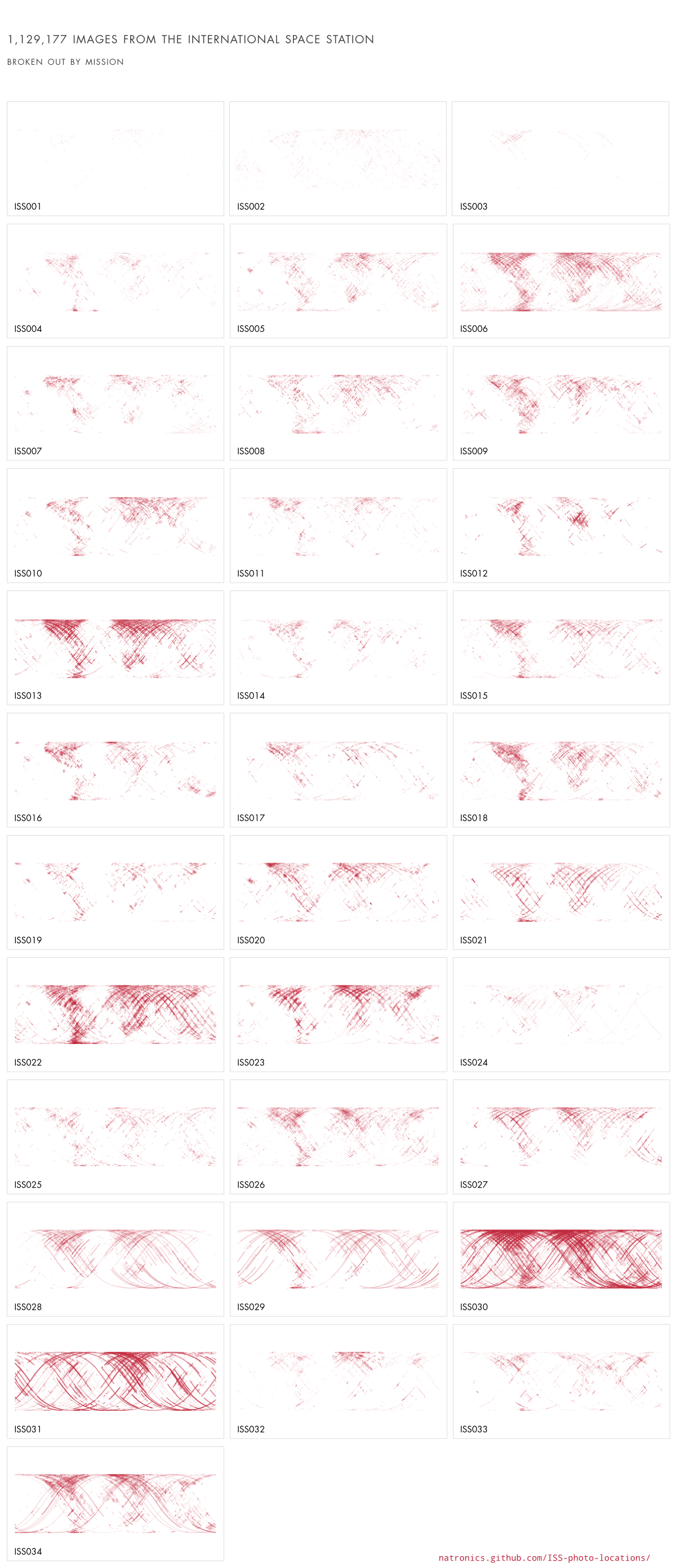
The sudden explosion during ISS 30 is really evident here. And it looks like time lapses started becoming popular around ISS 28.
This is just some of the data that NASA has to offer. If you’re interested in getting involved in things like this I suggest taking a look at data.nasa.gov, International Space Apps Challenges, spacehack.org and of course, downloading this dataset.
Because this data is from NASA it is in the public domain. If you do end up using it I’d be interested in hearing about it. Feel free to drop me a line if you end up making something with it.
Footnotes